Gravel biking in Malibu

For starters, does Malibu have gravel? Actually, tons of it given all the fire roads and so-called “motorways.” However, it is not well-documented nor differentiated from MTB trails. I posit the gravel scene in Malibu is potentially epic, but somebody has to inventory it and that person is not me.

Gravel in Malibu offers especially remote and beautiful trails, which beget otherworldly views. Regardless where you are staging there are gravel options. I like the climbs from PCH up into the canyons, such as Zuma Ridge, Puerco Canyon, and Big Rock, but there are also areas like Chesebro, Point Mugu State Park, and Topanga State Park.

Zuma is my favorite; here is a breakdown of a few climbs.

1. Zuma Ridge, https://www.strava.com/routes/3160361517346730138

Description: 100% gravel; steady climb, but does descend after about 2.5 miles of dirt then climbs, again. Nothing technical.

Gravel Climb: 4 miles, 9% gradient, https://www.strava.com/segments/672900

Helpful Hints: Don’t veer left towards power towers, stay on trail which flattens and descends.

Suggested Route / Extensions: I usually descend paved Encinal Canyon and then climb from PCH, but one could keep to the dirt for out and back — access by water facility near top of Encinal Canyon. Add any of the adjacent canyons; e.g. quick out and back up Trancas Canyon (but only if you like steeps!)

2. Puerco Canyon, https://www.strava.com/routes/3160359461489526220

Description: 100% gravel, which undulates. Take Puerco Canyon, then Mesa Peak, take right on Corral Canyon pavement for just a short bit, then Castro until Bulldog, which will be on your right. Turn around and go back to Corral Canyon pavement to descend and enjoy amazing views.

Gravel Climb: 7.5 miles, 5.6% gradient, https://www.strava.com/segments/35858699

Helpful Hints: Bulldog descent is not advised, nor is Tapia which GRAVELANGELES event used. Strava map suggested Castro would get through to Latigo, but it does not! Keep climbing until the Bulldog turn, but return back to Corral Canyon and descend.

More: An unexpected drawback is thorns given this route is less-traveled. Also, giant tarantula crossed my path…yikes!

Suggested Extensions: Add any of the adjacent canyons.

3. Big Rock, https://www.strava.com/segments/35900428

Description: 43% gravel from PCH to The Maze. Take paved Big Rock Drive until gate. After gate, continue on paved surface for another half mile or so, which is especially steep. Then take dirt trail option on your left and climb with some undulation for a couple miles. Stay on primary climbing trail, until you reach gate, which abuts Tuna Canyon paved roadway.

Helpful Hints: if you stayed on main trail and ended up at gate, just backtrack short distance and climb up to The Maze, which is out and back.

Suggested Extensions: Lots of options after gate; descend right to PCH or climb left and from Tuna Canyon take sharp left on Saddle Peak, or stay on Tuna Canyon which becomes Fernwood and descends to Topanga.

Topanga State Park area is popular with gravel enthusiasts. For comprehensive list of options: https://gravelbikecalifornia.com/santa-monica-mountains-gravel/.

I checked out Dirt Mulholland and Canyonback, but for more of Topanga State Park: https://www.strava.com/routes/3164924710067294050

Depending on staging, JRA bike shop http://jrabikesandbrew.com/ offers gravel group rides, such as Point Mugu’s Sycamore Canyon: https://www.strava.com/clubs/225468/group_events/1520562.

Another popular area for gravel/dirt is Chesebro — miles of terrain with some punchy climbs, but you will again see many hikers and MTB cohorts.

Malibu offers enjoyable dirt/gravel, but incorporate the paved options for maximum gratification. If you have any questions, check with me (Joel Blatt) on Strava. Here is my Strava Heatmap for Malibu area.

Baxter Cabin at Mount Baker

Guest Book for Baxter Cabin:

“Quaint and rustic as hell, but in a good way.”

I stayed with my dog in mid-September (2023) for five nights.  It was perfect for us and ideal location for access to hikes and bike ride to Artist Point, which is about 23 miles from cabin.

We went full austere lifestyle, which is to say we didn’t use fridge, laundry, propane, compost, standalone heater or wood stove.  I brought my own steamer, toaster, and coffee maker.  I also brought food, which I augmented by visits to Graham’s grocery store, including wine.

There is plenty of space in the cabin, which provided ample room for yoga.  Also, plenty of seating to lounge.  

There is an inside toilet, but keep in mind it offers minimum privacy.  There is sink in bathroom, which appeared to drain into bucket.  Therefore, chose to use kitchen sink as primary.  There is an outside shower, which is kind of fun.  I also used and was already familiar with bathrooms at Forest Service, which is practically next door.

Parking at the cabin was quite easy for me as my Jeep could easily climb the looping driveway, but there is also lower parking.  Noise is not an issue, but you can see and hear the traffic given proximity to the road.  Be careful on the road, which concerned me with dog. 

The internet is strong and supports multiple devices.  However, I would suggest rebooting when you arrive and repeat, if necessary.  The password is WPA number found on back of router.

I brought bath towel, paper towels, garbage bags, and toilet paper, although there were some supplies.

I did not frequent any of the restaurants, so no comment.

House does get cold at night, but bed with extra blanket was fine.  House actually remains cold during day, given canopy of trees and thus shade.

I did not see any mice or other. Cabin was clean upon arrival and departure.

Road-biking in Bend/Central Oregon

Enjoy mountain passes, Deschutes River, lava fields and pastoral rural landscapes.

Three Sisters / Cascades

This missive answers question of “road-biking in Bend?” From May-October, the weather will comply. This question comes up, because Bend is deservedly well-regarded for mountain and gravel biking, but not necessarily road. Note: expect ODOT to clear all or part of McKenzie Pass and Cascade Lakes Highway by mid-May.

Excellent road-biking is plentiful, but it depends — you must expand geographic reach:

1. Hutch’s club/team plans annual rides of Cascade Lakes, McKenzie Pass/Three Creeks, Straight Creek/Quartzville, and Ochocos, for example.

2. Green Ridge, Lower Bridge, Sunriver/Paulina Lake, Smith Rock, Millican/Prineville, and Mount Hood are interesting options.

3. Skyliners, Twin Bridges, Cline Falls, and Awbrey Butte are proximate to Bend.

4. Aufderheide is wonderful.

5. Crater Lake is other-worldly.

Upside is group-riding options, including Hammerfest and Rubber Mallet on Tuesdays to Commons and Lower Bridge on Saturdays. Every three weeks Rubber Mallet goes up Cascade Lakes Highway, which is great ride. Comparatively, Bend’s group rides are worthy.

Downside (IMHO) is out and back routing is often required versus contiguous loops.

“BendCycling” on Google Groups provides miscellaneous notifications.

Central Oregon 500+ annual event showcases many of Bend’s favorite areas. Other road events have unfortunately withered as is the trend.

Road-Biking in Malibu (March/April, ’23)

Santa Monica Mountains (SMM)

If you like climbing and descending gorgeous canyons, this is the place. Compared to Santa Barbara, Tucson, and Paso Robles, Malibu area distinguishes itself as my favorite place to ride, period.

For geographic context, the SMM National Recreation Area (NRA) is the largest urban national park in the U.S. and World for that matter. The land mass is 246 square miles with exceptional routes throughout.

Ideally, stage in central location for optimum access. While you may prefer ocean proximity, the Pacific Coast Highway’s (PCH) congestion and shoulder-width are unpredictable. My preferred location provided immediate access to Mulholland Highway, near Agoura Hills.

To maximize positive experience, minimize city centers, major thoroughfares, and PCH. Mulholland Highway is fantastic going east or west, but weekend traffic is a circus per motorcycle and car clubs. Perhaps, explore dirt on weekends. Overall, traffic is non-issue in SMM.

Highlights:

Climbs: PCH and non-PCH, steep and gentle

PCH (west to east:) Deer Creek, Yerba Buena, Mulholland Highway, Decker Canyon, Encinal Canyon, Trancas Canyon, Latigo Canyon, Corral Canyon, Rambla Pacifico, Las Flores, Big Rock, and Tuna Canyon (with some weaving together, e.g. Las Flores and Rambla, Deer and Yerba, as well as out and backs, e.g. Trancas, Big Rock, and Corral Canyon)

Non-PCH: Stunt, Piuma, Little Sycamore, Rock Store, Westlake, Fernwood Pacific Drive, and Saddle Peak (prefer to climb Piuma and descend Stunt, descend Westlake via Decker/Mulholland and climb two miles back, climb Saddle Peak from Tuna Canyon from PCH or via Fernwood)

Favorite steep climbs: Deer Creek, Tuna (albeit against one-way,) Las Flores, Corral Canyon, and Decker

Favorite gentle climbs: Piuma, Latigo, Yerba Buena, and Mulholland

Routes, e.g.: Up Little Sycamore down Yerba up Deer from PCH to Yerba to Little Sycamore to Mulholland or Mulholland Highway down Cold Canyon up Piuma down Rambla cut over on Hume and climb up Las Flores up Schueren and descend Stunt or descend at Las Flores and take PCH (2.7 miles) up Tuna Canyon up Saddle Peak and down Stunt

Connectors: Lechusa between Decker and Encinal, Hume between Las Flores and Rambla, Schueren between Piuma and Stunt, and Cold Canyon between Piuma and Mulholland Highway

Navigation: Encinal descent for Decker and/or Trancas climbs, Mulholland descent for Yerba, Yerba descent for Deer Creek, Latigo descent for Corral Canyon and Potrero to Hidden Valley (easy day)

Warnings: blind corners, steep gradients, hairpin switchbacks, unique cambers, occasional fast cars/motorcycles, high-speed traffic on Malibu Canyon, Topanga Canyon Boulevard, and Kanan Dume

Road Closures and Characteristics: Link for updates, Tuna Canyon ascent is against limited one-way traffic, Rambla Pacifico is gated near PCH

Group rides: Selfie Sunday, Wednesday Worlds, Serious Cycling, plus in L.A. see List of Group Rides (e.g. NOW, Nichols,) see Pasadena (e.g. Montrose, Rose Bowl)

Hydration: fire station off Decker, Circle X Ranch Ranger Station off Yerba, just down from top of Stunt, restaurants and gas stations on PCH

Strava Heatmap: 203,000 feet of elevation gain in <2 months

Santa Monica Mountains

Appendix A / video:

Tom Pidcock descending Tuna Canyon (also has KOM on 7-Minute Hill)

Appendix B / Climbs:

Deer Creek: 11.4%/2.2 (steeps from the start)

Corral Canyon: 7%/5.4 (crazy steep for first 3 miles, but flattens; out and back)

Decker Canyon: 7.8%/3.6 (bit of reprieve in middle)

Rambla Pacifico from Gate: 9%/3 (longer if you navigate gates from PCH)

Las Flores Canyon: 8.7%/3.2 (from PCH or Hume connector)

Tuna Canyon: 7.2%/6.4 (climbs against 1-way traffic; distance includes extension up Saddle Peak)

Trancas Canyon: 13%/1 (crazy steeps in spots)

Big Rock: 10%/1.6 (quite steep in spots)

Stunt: 6.6%/4 (cars seem to race up it, but pairs nicely with Piuma or Tuna Canyon)

Rock Store: 7.5%/2.3 (road closed since 2018 fire, but opening soon)

Piuma: 6.5%/5 (access via Cold Canyon or Las Virgenes for more elevation)

Westlake: 7.8%/2 (expect some traffic from Westlake Village and descend carefully)

Fernwood: 6.7%/5 (higher population/traffic density)

Schueren: 6%/1.7 (great connector off Rambla, between Stunt and Piuma)

Latigo: 5.4%/6.8 (undulating; from Kanan it actually climbs, then descends nicely to PCH)

Yerba Buena: 5.2%/8 (great descent or long sustained climb; my PR was 46 minutes)

Mulholland from PCH: 3.7%/9 (great descent or climb)

Encinal Canyon (2): 5.4%/5 and 6.3%/1.7 (picturesque near PCH; fast descent with prevalence of cars/motorcycles on weekends)

Little Sycamore Canyon: 5%/2.8 (some of my favorite canyon views)

Old Topanga (2): 5.2%/1.7 and 3.5%/4.1 (bit congested)

7-Minute: 3.6%/2 (last push of Wednesday Worlds group ride)

Appendix C / Gravel:

Point Mugu, Encinal-Yerba, and Puerco Canyon

——————————————————————————————————

Contact:

Comment on Strava with any questions.

Road-Biking in Tucson (Winter ’22/’23)

If you want warm winter weather, consider Tucson. I spent November through February. There were the occasional inclement days, but not too many. Snow on Mount Lemmon can also affect full-ascents, but you can mitigate with staying lower on the climb and doing repeats.

However, bring your winter apparel for chilly descents of Mount Lemmon, as well as early-morning Shootouts. If you wait until the afternoon, it does warm up.

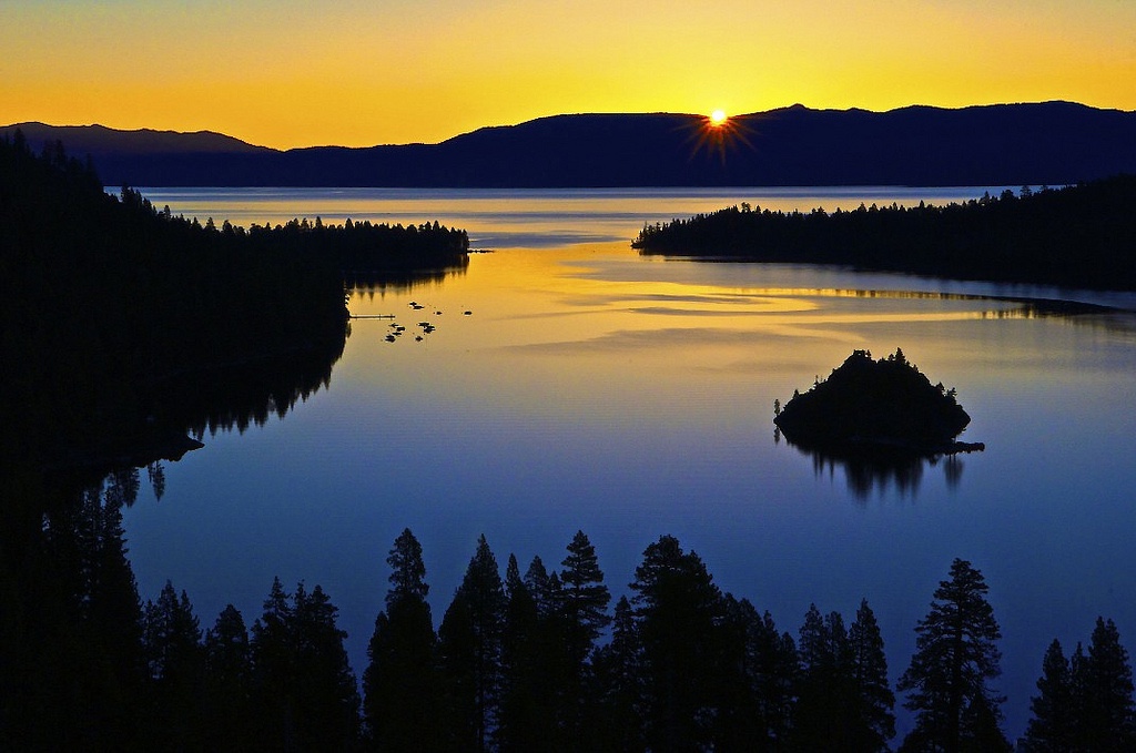
For geographic context, the city of Tucson is surrounded by five mountain ranges. The most prominent, the Santa Catalina Mountains to the north, the Santa Rita Mountains to the south, the Tucson Mountains to the west, Rincon Mountains to the east, and the Tortolita Mountains to the northwest. Plus, Redington Pass separates the Rincon Mountains from the Santa Catalina Mountains.

Highlights:

If climbing (power:weight ratio) is your bailiwick, Mount Lemmon starts with sustained ~5% gradient for 20 miles (5,000+ feet of elevation) and then undulates to tiny town of Summerhaven. Optionally, take right at Ski Run/Hill Road for about 3 miles to ascend to ~9,000 feet. I did full-ascent six times.

Madera Canyon (Mount Wrightson) is another great climb from Green Valley. The last 5 miles is >6% gradient and the last 1 mile (from Santa Rita Lodge) is a beast. If you are doing Saturday Shootout, Madera Canyon is a challenging add-on. I did full-ascent six times.

Other “showcase” climbs are Mount Graham and Kitt Peak. Given elevations, check weather conditions in advance. Kitt Peak is officially closed, but people still ride it. Both are outside of Tucson metro area.

If you seek competitive group riding, consider Saturday “Shootout” with A/B/C alternatives at 15 minute intervals. Group rides start near university, but you can join along Mission. Just make sure to join before Strava’s 50-mile segment, which is where Mission crosses Los Reales, around and back to same spot.

As you near Los Reales cross-street, expect MPHs to increase in earnest. While speeds will vary, expect A-group to average ~23.5 MPH with nasty surges, while B-group will average ~21.5 MPH. Group size also varies, but expect dozens of riders, which only increases as of January.

The Shootout heads south via Mission and circles back on Sahuarita/Helmet Peak. There is one bump, Shootout Hill. Check website for start times, which change per season. For added intensity, add Madera Canyon and/or Gates Pass. I completed Madera add-on three times and Gates Pass one time. Somehow, I showed up every Saturday from November through February. Only once did it rain and there no crashes. But, some of the early morning starts were hella chilly.

Saguaro National Park has two locations, one on east and one on west side of Tucson. At east park, pay $15 via credit card for one week privileges or buy pass for extended stay. There is undulating 8-mile loop, which is quite scenic. To the west, you traverse and loop around; there is no fee for biking in the area.

Routes start from all cardinal directions:

West: On the west side of Tucson Mountains, enjoy secluded (flat) roads with picturesque views as you extend west into Avra Valley. On the east side of Tucson Mountains, explore out and backs. Loop around via Ajo Highway or Irvington to the south or Ina Road to north. Otherwise, cross over Tucson Mountains via Gates Pass, which offers climbs going both directions, but also more traffic than desired.

Road-quality will vary and Tucson continues road-improvements. McCain Loop is poor surface, as is Sentinel Peak/A-Mountain. Picture Rocks is pretty, but has significant traffic. Trails End has new surface and is good for repeats. Sunset is another favorite and both boast low traffic.

East: Mount Lemmon is a rite of passage. Otherwise, access popular routes via The (Chuck Huckelberry) Loop including Saguaro East NP, Colossal Cave, Pistol Hill, Marsh Station, and Rincon Valley. You can also go towards Vail, Corona de Tucson, and Sahuarita for extended mileage.

South: You can ride the Shootout route or derivatives, including Madera Canyon and Gates Pass add-ons. Further south, there is a secluded ride from Amado to Arivaca out and back, which you can extend further towards Mexico border.

North: Routes are best accessed via The Loop (Canada del Oro;) wise to avoid Oracle highway. Near end Canada del Oro you can take First north, which offers bike path to Tangerine and then west to Twin Peaks or out and back via Dove Mountain.

As the maxim goes, location is everything. Therefore, your first decision is staging. I chose east side of Tucson, largely for Mount Lemmon. However, if I was coming again, I would stage on west side, thus closer to Shootout and other routes west, south, north. Most cyclists do stay on east side of town.

A metric that matters is distance from The Loop, because it can enable myriad routes. Pima County maintains Loop, by sweeping and clearing any obstructions, immediately after weather events. The (Chuck Huckelberry) Loop circumnavigates Tucson’s urban jungle, which is a blessing. The Loop is virtually contiguous per myriad River Parks and Greenways (below,) which connected create 54-mile loop, plus tangents. Don’t expect perfect placards when riding Loop, but overall it is well-maintained and useful.

Inventory expands by driving further to starts in all directions. Mount Graham is 2-hour drive from Tucson. There are a few regional winter races, as well as State Championship event in September. In November, El Tour de Tucson attracts 7,500+ cyclists, including some of your favorite former World Tour pros. In March, there is Tucson Bicycle Classic, which is road stage race, as well as gravel Belgian Waffle Ride in Phoenix area.

Want gravel? The place is Patagonia; see Spirit World for courses; other popular routes, include Box Canyon and Mount Hopkins. Redington Pass is another challenging gravel ride. For MTB, see routes here. Swim much? Four heated city pools are open all year and admission is free. Too many excellent hiking options to list.

Endemic flora and fauna? Obviously, cacti is everywhere, but in Sahuarita there are rows and rows of pecan trees. When wandering through the canyons be on the lookout for squadrons of javelina. I’ve also seen two bobcats, deer, many coyotes and roadrunners. If you are considering Arivaca ride, consider extension to Buenos Aires refuge and its many species.

Tucson “winter sojourn” spanned October 29, 2022, through February 28, 2023. My weekly rhythm centered on Saturday Shootout, as well as Loop cruiser rides, hill repeats, and long-ride activities. Whereas, I assumed I would ride Mount Lemmon every week, the full-descents were just too cold for that to materialize. Late in the game, I realized you could do repeats on the lower sections of Lemmon.

In March and April, 2023, I am relocating to Santa Monica Mountains. To be continued…under separate cover.

Previous winters covered Santa Barbara County, as well as two winters in San Luis Obispo County. For comparison, Tucson stacks up well with strong cycling culture and fantastic weather. The drawback with Tucson is its sprawling geography, but if you simply want to train like a pro, this is the place.

Paso Robles offers superior “hub” for access/inventory to road and gravel routes. The climbs are challenging; scenery is great; population/traffic density is low. With a short drive to South County, one can access many more great rides.

Santa Barbara offers breathtaking views per epic climbs, e.g. Gibraltar. There are also group rides. The only drawbacks are high population/traffic density and at times road-quality.

Feel free to reach out (Comment on Strava,) if you have questions. This is also published on my Outbound page with other similar stories. All in all, I highly recommend Tucson for your next winter sojourn.

Planning Methodology

Tourism is about stories and memories. Rarely does one have travel regrets, but why take chances?  Increase probability of positive outcomes by enforcing planning methodology.  Pre-determine trip theme, much like identifying objectives with business plan.  

Apply methodology, consider following:

Q: Duration of trip?

Q: International or domestic?

Q: Metropolitan or remote? 

Q: Active or relaxation?

Q: Beach, mountain or lake?

Use Venn diagram, because questions overlap.  For example, you may want beach, but remote with low population density and access to hiking.  Perhaps, you want helicopter backcountry hiking/skiing with fine dining at rustic or fancy CMH lodge.  

Drill-down further:

Q: Ease of logistics, including travel time?

Q: 5-star hotel or rustic/austere?

Q: Access to museums, churches, and restaurants?

Q: Crowds and related population density?

Q: Access to hiking and other activities?

Q: Aesthetic preferences, e.g. alpine lake, mountain, or ocean views?

Q: Specialty, such as helicopter access, guides?

Don’t be biased by my favorites, which lean int’l and include:

  • Trekking in Peru, including Choq’ekiraw and Machu Picchu
  • City tours of Barcelona, Milan, Madrid, Paris, Montreal, Toyko, Sydney, Auckland, Rio de Janeiro, Buenos Aires
  • Lake Como, Lake Tahoe, and myriad lakes in Canadian Rockies
  • Helicopter/backcountry skiing and hiking (e.g. CMH, Assiniboine Lodge)
  • Angkor Wat in Cambodia
  • Iguazu Falls in Argentina/Brazil
  • French Polynesia, including Bora Bora and others
  • Canadian Rockies, including Banff/Lake Louise

Safe travels.

Double-check that itinerary

Weeks from overwater bungalow trip to Bora Bora, double-checked my Delta Airlines reservation per their website.  Unbeknownst, return flight from Tahiti was no longer confirmed.  Would I have shown up for return flight only to be rebuked?  One can only speculate.  Delta could not provide explicit answer.

Let’s posit possible explanations.  Since reservation was made with miles, it had low priority.  Since reservation was made through Delta’s partner airline, Air Tahiti Nui, it had low priority.  What likely transpired is my seats were sold by Air Tahiti Nui, upon reaching maximum occupancy.

Again, speculating at a more granular level, the breakdown had to do with software workflow and communication.  Once my seats were sold by Air Tahiti Nui, Delta should have been automatically (electronically) notified, which should have automatically (electronically) notified me.  I can state as a matter of fact, I was not notified.

I got a refund and booked on United, which had more elegant routing.  “Life is too short for extended layovers.”

Cool site: Outbound Collective

OC

In former life, many travels were to global cities, such as Paris, Madrid, London, and Sydney.  In current life, girlfriend favors nature to urban.  Therefore, we emphasize hiking and related activities to museums and churches.  To be honest, I don’t really miss walking through churches or crowded museums.

I’ve chosen to publish our “activities” on The Outbound Collective.

Take a peak.


summer mountain excursions

Mount Hood is a 2-hour drive from Bend, but provides much cooler climate with majestic mountain and alpine lakes.  This time we stayed in rustic cabin two miles from Trillium Lake.  Activities included three lake hikes and repeats to Timberline Lodge.

Our first hike was Trillium Lake Loop, which is in utter disrepair.  However, the problem with Trillium Lake is crowds – if you want to see Trillium lake, do it at dawn or dusk.

If you like to road bike, there is a great climb up main road to historic Timberline Lodge.  From bottom to top, trip was ~5.5 miles with 1,900 feet of elevation gain – I did 2 repeats.  After bike, we drove to Veda Lake TH, which is ~45 minute drive from highway along one of the worst roads you will ever find.  However, our second lake hike (short Veda Lake hike) was glorious with epic views of Mount Hood and culminates in serene lake setting.

Our third lake hike was Mirror Lake Loop.  Again, get there early for parking and avoiding crowds.  Pretty lake, but add the Tom Dick and Harry extension.

Trillium Lake:

Mirror Lake:

The Oregon Alps (aka Wallowas)

Joseph, Oregon is an enigma.  Ask around and most have heard of it, but few have actually visited.  Well, we decided to book 7 nights at a cabin on Wallowa Lake.  The area has a certain majesty given the volume of glaciated peaks.  Summers are wonderful, but safe to guess Winters are harsh.  Suffice to say, we loved it!

We compiled 7 days of day hiking with Nessie, however the bang for your buck is backpacking or trekking in this region.

See photos:  Wallowas